- Custer County, Nebraska
-
Custer County, Nebraska  Custer County Courthouse in Broken Bow, Nebraska
Location in the state of Nebraska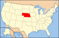
Nebraska's location in the U.S.Founded February 17, 1877 Named for George Armstrong Custer Seat Broken Bow Largest city Broken Bow Area
- Total
- Land
- Water
2,576 sq mi (6,672 km²)
2,576 sq mi (6,671 km²)
0 sq mi (1 km²), 0.01Population
- (2000)
- Density
10,939Time zone Central: UTC-6/-5 Website http://www.custercounty.com/ Custer County is a county located in the U.S. state of Nebraska. As of 2010, the population was 10939. Its county seat is Broken Bow.[1]
In the Nebraska license plate system, Custer County is represented by the prefix 4 (it had the fourth-largest number of vehicles registered in the county when the license plate system was established in 1922).
Contents
Geography
According to the U.S. Census Bureau, the county has a total area of 2,576 square miles (6,671.8 km2), of which 2,576 square miles (6,671.8 km2) is land and 0 square miles (0.0 km2) (0.01%) is water. In area, it is the second largest county in Nebraska, only Cherry County being larger.
Major highways
 U.S. Highway 183
 Nebraska Highway 2
 Nebraska Highway 21
 Nebraska Highway 40
 Nebraska Highway 47
 Nebraska Highway 70
 Nebraska Highway 92
Adjacent counties
- Valley County, Nebraska - (Northeast)
- Sherman County, Nebraska - (Southeast)
- Buffalo County, Nebraska - (Southeast)
- Dawson County, Nebraska - (South)
- Lincoln County, Nebraska - (Southwest)
- Logan County, Nebraska - (Northwest)
- Blaine County, Nebraska - (Northwest)
- Loup County, Nebraska - (Northeast)

Logan County and Blaine County Valley County and Loup County 
 Custer County, Nebraska

Lincoln County Dawson County Sherman County and Buffalo County History
Custer County was formed in 1877. It was named after General George Armstrong Custer,[2] who was killed at the Battle of Little Bighorn.
Demographics
Custer County
Population by decade1880 - 2,211
1890 - 21,677
1900 - 19,758
1910 - 25,668
1920 - 26,407
1930 - 26,189
1940 - 22,591
1950 - 19,170
1960 - 16,517
1970 - 14,092
1980 - 13,877
1990 - 12,270
2000 - 11,793As of the census[3] of 2000, there were 11,793 people, 4,826 households, and 3,320 families residing in the county. The population density was 5 people per square mile (2/km²). There were 5,585 housing units at an average density of 2 per square mile (1/km²). The racial makeup of the county was 98.63% White, 0.07% Black or African American, 0.41% Native American, 0.15% Asian, 0.20% from other races, and 0.55% from two or more races. 0.92% of the population were Hispanic or Latino of any race. 37.3% were of German, 11.9% English, 10.6% Irish and 8.9% American ancestry according to Census 2000.
There were 4,826 households out of which 30.30% had children under the age of 18 living with them, 60.90% were married couples living together, 5.40% had a female householder with no husband present, and 31.20% were non-families. 28.90% of all households were made up of individuals and 15.00% had someone living alone who was 65 years of age or older. The average household size was 2.39 and the average family size was 2.95.
In the county the population was spread out with 26.30% under the age of 18, 5.50% from 18 to 24, 23.50% from 25 to 44, 23.70% from 45 to 64, and 21.10% who were 65 years of age or older. The median age was 41 years. For every 100 females there were 96.10 males. For every 100 females age 18 and over, there were 91.70 males.
The median income for a household in the county was $30,677, and the median income for a family was $37,063. Males had a median income of $24,609 versus $19,732 for females. The per capita income for the county was $16,171. About 9.10% of families and 12.40% of the population were below the poverty line, including 16.20% of those under age 18 and 9.10% of those age 65 or over.
Localities
Cities
Villages
Other communities
Townships
- Algernon (includes village of Mason City)
- Ansley (includes village of Ansley)
- Arnold (includes village of Arnold)
- Berwyn (includes village of Berwyn)
- Broken Bow (surrounds, but does not include, city of Broken Bow)
- Cliff
- Comstock (includes village of Comstock)
- Corner
- Custer
- Delight (includes village of Callaway)
- Douglas Grove
- Myrtle
- Ryno
- Sargent (includes city of Sargent)
- Spring Creek
- Triumph
- Victoria (includes village of Anselmo)
- Wayne
- Westerville
- West Union
- Wood River (includes village of Oconto)
See also
References
- ^ "Find a County". National Association of Counties. http://www.naco.org/Counties/Pages/FindACounty.aspx. Retrieved 2011-06-07.
- ^ [1] Retrieved on March 14, 2008.
- ^ "American FactFinder". United States Census Bureau. http://factfinder.census.gov. Retrieved 2008-01-31.
Municipalities and communities of Custer County, Nebraska Cities 
Villages Townships Algernon | Ansley | Arnold | Berwyn | Broken Bow | Cliff | Comstock | Corner | Custer | Delight | Douglas Grove | East Custer | Elim | Elk Creek | Garfield | Grant | Hayes | Kilfoil | Lillian | Loup | Milburn | Myrtle | Ryno | Sargent | Spring Creek | Triumph | Victoria | Wayne | Westerville | West Union | Wood River
Unincorporated
communitiesCategories:- Nebraska counties
- Custer County, Nebraska


Wikimedia Foundation. 2010.