- Neponset River
-
Neponset River 
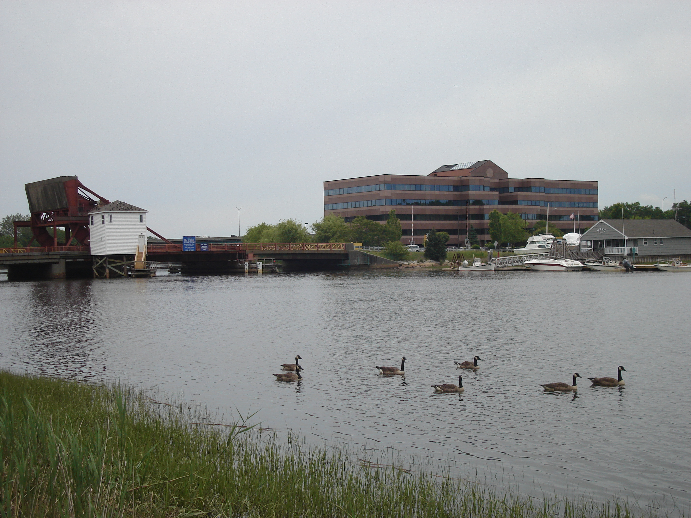
Neponset River with Granite Avenue in backgroundBasin countries United States Length 29 mi (47 km) The Neponset River is a river in eastern Massachusetts in the United States. The headwaters of the Neponset are at the Neponset Reservoir in Foxborough, near the Gillette Stadium. From there, the Neponset meanders generally northeast for approximately 29 miles (47 km) to its mouth at Dorchester Bay between Quincy and the Dorchester section of Boston, near the painted gas tank.[1]
The Neponset River forms the southern boundary of the city of Boston, through the neighborhoods of Readville, Hyde Park, Mattapan and Dorchester, with the northern border of the city of Quincy. In addition, the Neponset touches the towns of Foxborough, Walpole, Sharon, Norwood, Canton, Westwood, Dedham, and Milton.
The Neponset River is fed by a drainage basin or watershed of approximately 130 square miles.[1] The Neponset River watershed includes numerous aquifers, wetlands, streams and surrounding upland areas. In addition to the towns listed above, the watershed includes portions of Stoughton, Medfield, Dover, and Randolph. Altogether some 250,000 people live in the Neponset River watershed.
Contents
History
The falling waters of the Neponset provided the energy for the country's first water-powered grist mill, gunpowder mill, paper mill and the Revere Copper Company, among others.[1]
The river's recorded history begins in 1619 when fur trading started by the English on Thompson's Island, and Native Americans used the Neponset River to bring skins for sale.[2]
The upper stretch of the Neponset River, in Foxborough, Walpole and Norwood, is steeply sloped, however, dropping about 228 feet (69 m) over its first 12 miles (19 km) and so the earliest years of the Industrial Revolution truly brought the Neponset to prominence. In 1635, Israel Stoughton built the first dam on the Neponset (only the second dam in entire New World) for his grist mill. It was the first of three mills for flour, gun powder and paper making. In 1640 shipbuilding began at Gulliver's Creek Wharf, and in 1673 John Trescott built a lumber mill on the river.
In 1765, a chocolate mill was established by Dr. James Baker and Irish immigrant John Hannon (later known as Baker's Chocolate) in the Lower Mills section of Dorchester, and in 1770 Daniel Vose's Wholesale Shipping Warehouses at the second Milton Town Landing at Lower Mills were at the peak of their operation. Ship building and commercial shipping were the major river industries at the estuary. In 1773 George Clark built a paper mill on remnants of Trescott's Lumber Mill, which became the Tileston and Hollingsworth Paper Mill in 1836. And in 1826, the river became the terminus of the Granite Railway, the first commercial railway in the United States. This river was central to the establishment of the town of Walpole.
Tributaries
A tributary of the Neponset River located in Canton, Massachusetts, is called the Canton River, which flows under the Canton Viaduct.
Pollution and cleanup
After much remediation, the Neponset is now cleaner than it has been for almost two centuries. At present two dams block fish from entering the river; there is some pressure for their removal.
Recreation
Today the Neponset River and its watershed are increasingly being protected and opened up as a recreational destination for the benefit of local residents. Several recommendations of the 1966 Lower Neponset River Reservation Master Plan have been implemented, including the reclamation of the former Hallet Street landfill and the old Neponset Drive-In to provide the 66-acre (270,000 m2) Pope John Paul II Park, which opened to the public in 2001. At Squantum Point in Quincy, phase one of Squantum Point Park, 25 acres (100,000 m2) of a 50-acre (200,000 m2) former U.S. Navy Airfield, was developed as waterfront parkland with assistance from National Grid plc and dedicated in the spring of 2001. Also 2.4 miles (3.9 km) of the Lower Neponset River Trail opened in 2003.[3]
References
- ^ a b c Neponset River Watershed Association, Watershed, http://www.neponset.org/Watershed.htm, retrieved 2009-10-17
- ^ MassBike, Neponset River: A History, http://www.massbike.org/bikeways/neponset/nephist.htm, retrieved 2009-10-17
- ^ DCR Neponset River Reservation page
External links
- Neponset River - MWRA Massachusetts Government Web site
- Massbike site on the Neponset
- Neponset River Watershed Association
- Neponset watershed map
- River Bank Destruction, Squantum Point , Neponset River
Protected Areas of Massachusetts Federal Adams · Boston · Boston African American · Frederick Law Olmsted · John Fitzgerald Kennedy · Longfellow House · Lowell · Minute Man · New Bedford Whaling · Salem Maritime · Saugus Iron Works · Springfield Armory
Appalachian National Scenic Trail · Boston Harbor Islands National Recreation Area · Cape Cod National Seashore · Stellwagen Bank National Marine Sanctuary · Waquoit Bay National Estuarine Research Reserve · West Hill Dam
Assabet River · Great Meadows · Mashpee · Massasoit · Monomoy · Nantucket · Nomans Land · Oxbow · Parker River · Silvio O. Conte · Thacher Island
State Alewife Brook · Ames Nowell · Ashland · Bash Bish Falls · Blackstone River and Canal Heritage · Borderland · Boston Harbor Islands · Bradley Palmer · C. M. Gardner · Callahan · Castle Island State Park · Chicopee Memorial · City Square · Clarksburg · Cochituate · Connecticut River Greenway · Demarest Lloyd · Dighton Rock · Dunn · Ellisville Harbor · Fall River Heritage · Gardner Heritage · Great Brook Farm · Halibut Point · Hampton Ponds · Holyoke Heritage · Hopkinton · Lake Lorraine · Lake Wyola · Lawrence Heritage · Lowell Heritage · Lynn Heritage · Massasoit · Maudslay · Moore · Mount Holyoke Range · Natural Bridge · Nickerson · Pearl Hill · Pilgrim · Quinsigamond · Robinson · Roxbury Heritage · Rutland · Skinner · South Cape Beach · Wahconah Falls · Webb Memorial · Wells · Western Gateway Heritage · Whitehall · Wompatuck
State Parks:
ReservationsBeaver Brook · Belle Isle Marsh · Blue Hills · Breakheart · Charles River · Chestnut Hill · Cutler · Dorchester Shores · Elm Bank · Fort Phoenix · Hammond Pond · Hemlock Gorge · Horseneck Beach · Jug End · Lynn Shore · Middlesex Fells · Mount Everett · Mount Greylock · Mount Sugarloaf · Mount Tom · Myles Standish · Mystic River · Nahant Beach · Nantasket Beach · Nasketucket Bay · Neponset River · Pope John Paul II · Purgatory Chasm · Quincy Quarries · Quincy Shore · Revere Beach · Rumney Marsh · Salisbury Beach · Sandy Point · Scusset Beach · Stony Brook · Upper Charles River · Wachusett Mountain · Walden Pond · Weymouth · Wilson Mountain
State Parks:
OtherAppalachian Trail · Ashuwillticook Rail Trail · Cape Cod Rail Trail · Fort Revere · Lake Dennison Recreation Area · Lower Neponset River Trail · Nashua River Rail Trail · Norwottuck Rail Trail · Quabbin Reservoir · Southwest Corridor Park · Squantum Point Park · Streeter Point Recreation Area · Sudbury Reservoir · Wachusett Reservoir · Ware River Watershed Area
Barnstable · Beartown · Brimfield · Chester-Blandford · DAR · Douglas · Erving · F. Gilbert Hills · Federated Women's Club · Freetown-Fall River · Georgetown Rowley · Granville · Harold Parker · Kenneth Dubuque Memorial · Leominster · Lowell-Dracut-Tyngsboro · Manuel F. Correllus · Mohawk Trail · Monroe · Mount Grace · Mount Washington · Myles Standish · October Mountain · Otter River · Pittsfield · Sandisfield · Savoy Mountain · Shawme-Crowell · Spencer · Tolland · Upton · Wendell · Willard Brook · Willowdale · Windsor
Agawam Lake · Agawam Mill Pond · Ashby · Ashfield Hawley · Attitash · Ayer Game Farm · Baddacook Pond · Bakers Pond · Bay Circuit Trail · Bearse Pond · Becket · Bennett · Birch Hill · Black Brook · Blackstone / West River · Bolton Flats · Boxboro Station · Brayton Point Salt Marsh · Breakneck Brook · Brewer Brook · Bullock Ledge · Burrage Pond · Canoe River · Catamount · Chalet · Chase Garden Creek Salt Marsh · Childs River · Chockalog Swamp · Church Homestead · Clapps Pond · Clinton Bluff · Concord River · Connecticut River · Cook Pond · Copicut · Coy Hill · Crane Pond · Cummington · Cusky Pond · Dartmoor Farm · Darwin Scott Memorial · Day Mountain · Deerfield River · Dogfish Bar Beach Coastal · Dolomite Ledges · Dunstable Brook · E. Kent Swift · Eagle Island · East Mountain · Eastham Salt Marsh · Elbow Meadow · English Salt Marsh · Eugene D. Moran · Facing Rock · Fairfield Brook · Farmington River · Fish Brook · Fisherville Pond · Fisk Forestdale Lot · Fisk Meadows · Five Mile River · Flagg Swamp · Flint Pond · Four Chimneys · Fox Den · Fox Island Salt Marsh · Frances A. Crane · Freetown Swamp · George L. Darey Housatonic Valley · Glen Echo Lake · Gosnold · Grassy Pond (Dennis) · Grassy Pond (Plymouth) · Green River (Franklin County) · Green River (Berkshire County) · Greenfield River · Halfway Pond · Hamilton · Hancock · Harlow / Cooks Pond · Haskell Swamp · Hauk Swamp · Hawksnest State Park · Hawley · Head Of The Plains · Herman Covey · High Ridge · Hinsdale Flats · Hiram H. Fox · Hockomock Swamp · Hog Pond Lot · Honey Pot · Hoosatonic River · Hoosic River · Hop Brook · Housatonic River · Hubbard Brook · Hunting Hills · Hyannis Ponds · Ipswich River · John J. Kelly · Jug End Fen · Jug End · Kampoosa Fen · Katama Plains · Knops Pond · Konkapot River · Lackey Pond · Lake Lorraine · Lake Rohunta · Lake Snipatuit · Lake Warner · Lanesboro · Lawrence Brook · Lawrence Pond Lot · Leadmine · Leyden · Lilly Pond · Little Alum Pond · Long Sought For Pond · Maple Hill · Maple Springs · Martha Deering · Martin H. Burns · Mascuppic Lake · Mashpee Pine Barrens · Mashpee Pond Lot · Mashpee River · Massachusetts Military Reservation · Mckinstry Brook · Meetinghouse Swamp · Merrill Pond · Miacomet Heath · Mill River · Millers River · Mine Brook · Montague Plains · Montague · Moose Brook · Moose Brook · Moose Hill · Mossy Pond · Mount Watatic Reservation · Mt. Esther · Mt. Toby Highlands · Mt. Toby · Mt. Tom · Muddy Brook · Muddy Pond · Mulpus Brook · Nashua River · Natty Brook · Nemasket River · Nissitissit River · Noquochoke · Nordeen Marsh · North Brookfield · North Shore Salt Marsh · Northboro · Oakham · Olivers Pond · Orange · Otis · Packard Pond · Palmer · Pantry Brook · Pauchaug Brook · Peru · Peterson Swamp · Phillipston · Podunk Marsh · Poland Brook · Popple Camp · Popponesset Beach · Poutwater Pond · Powell Brook · Prince River · Provincetown Route 6 Corridor · Purchade Brook · Quaboag · Quacumquasit · Quag Pond Bog · Quashnet River · Quashnet Woods State Reservation · Quinapoxet River · Quinsigamond Marsh · Quisset · Raccoon Hill · Rainbow Beach · Red Brook · Richardson · Robbins Pond · Rochester · Rocky Gutter · Rowe · Salisbury Salt Marsh · Salisbury Salt Marsh · Sandwich Game Farm · Sandy Pond · Satan's Kingdom · Savage Hill · Savoy · Sawmill River · Scorton Creek Coastal · SE Mass Bioreserve · Sevenmile River · Shattuck Brook · Sheperds Island · Shubael Pond · Sibley Brook · Sly Pond · South Barrier Beach · South Meadow Pond · South Shore Salt Marsh · South Triangle Pond · Southampton · Southwick · Spectacle Pond · Springhill Lot · Sputtermill Pond · Squannacook River · Stafford Hill · Sudbury River · Sunderland Islands · Taconic Mountain · Taunton River · Taunton River · Tekoa Mountain · Thad Ellis · Thayer Pond · Three Mile Pond · Townsend · Townsend Hill · Trapfall Brook · Triangle Pond · Tully Brook · Tully Mountain · Tully River · Wakeby Pond · Wales · Walnut Hill · Ware River · Warwick · Wendell · West Meadows · Westboro · Westfield River · Westfield · Weymouth Back River · Whately Great Swamp · Whately Ponds · Whately · Wilbraham Game Farm · William Forward · Williams River · Williamsburg · Winimusset · Wolf Swamp ·Billingsgate Island · Carr Island · E. Howe Forbush · Egg Rock · Grace A. Robson · J.C. Phillips · Knight · Penikese Island · Ram Island (Salisbury) · Ram Island (Mattapoisett) · Susan B. Minns · Tarpaulin Cove · Watatic Mountain ·Private Roger and Virginia Drury Preserve · Tatkon Preserve · McElwain-Olsen Preserve · Reed Brook Preserve · Hawley Bog Preserve · Stacy Mountain Preserve · Greene Swamp Preserve · Black Pond Bog Nature Preserve · Halfway Pond Island Preserve · Grassy Pond Preserve · Boat Meadow Preserve · Sandy Neck Preserve · Hockomock Swamp · David H. Smith Preserve and Fire Trail · Hoft Farm Preserve · Katama Plains Preserve · Francis Newhall Woods Nature and Wildlife Preserve · Miacomet Moors Preserve · Homer-Watcha Preserve ·
Agassiz Rock · Appleton Farms · Appleton Farms Grass Rides · Ashintully Gardens · Bartholomew's Cobble · Bear's Den · Bear Swamp · Colonel John Ashley House · Francis William Bird Park · Eleanor Cabot Bradley Estate · Bridge Island Meadows · Brooks Woodland Preserve · William Cullen Bryant Homestead · Cape Poge Wildlife Refuge · Cedariver · Castle Hill · Chapel Brook · Charles River Peninsula · Chase Woodlands · Chesterfield Gorge · Coolidge Reservation · Copicut Woods · Cormier Woods · Coskata-Coatue Wildlife Refuge · Crane Beach · Crane Wildlife Refuge · Crowninshield Island · Dexter Drumlin · Dinosaur Footprints · Doane's Falls · Doyle Reservation · Dry Hill · East Over Reservation · Elliott Laurel · Field Farm · Fork Factory Brook · Glendale Falls · Goose Pond Reservation · Greenwood Farm · Halibut Point Reservation · Hamlin Reservation · Holmes Reservation · Governor Hutchinson's Field · Jacobs Hill · Little Tom Mountain · Long Hill · Long Point Wildlife Refuge · Lowell Holly Reservation · Lyman Reserve · Malcolm Preserve · Mashpee River Reservation · McLennan Reservation · Medfield Meadow Lots · Medfield Rhododendrons · Menemsha Hills · Misery Islands · Mission House · Monument Mountain · Moose Hill Farm · Mount Ann Park · Mountain Meadow Preserve · Mytoi · Naumkeag · Noanet Woodlands · Noon Hill · Norris Reservation · North Common Meadow · Norton Point Beach · Notchview · Old Manse · Old Town Hill · Peaked Mountain · Pegan Hill · Peters Reservation · Petticoat Hill · Pierce Reservation · Pine and Hemlock Knoll · Powisset Farm · Questing · Quinebaug Woods · Ravenswood Park · Redemption Rock · Rock House Reservation · Rocky Narrows · Rocky Woods · Royalston Falls · Shattuck Reservation · Signal Hill · Slocum's River Reserve · Stavros Reservation · The Stevens-Coolidge Place · Swift River Reservation · Tantiusques · Tully Lake Campground · Two Mile Farm · Tyringham Cobble · Ward Reservation · Wasque · Weir Hill · Weir River Farm · Westport Town Farm · Whitney and Thayer Woods · World's End ·
Arcadia · Broad Meadow Brook · Broadmoor · Drumlin Farm · High Ledges · Ipswich River · North River · Pleasant Valley · Stony Brook · Wachussett Meadow · Wellfleet Bay
OtherConcord Land Conservation Trust · Harvard Forest · Lincoln Land Conservation Trust ·
Executive Office of Energy and Environmental Affairs (Massachusetts) Categories:- Neponset River
- Rivers of Norfolk County, Massachusetts
- Watersheds of Boston Harbor
Wikimedia Foundation. 2010.