- Alibunar
-
Alibunar
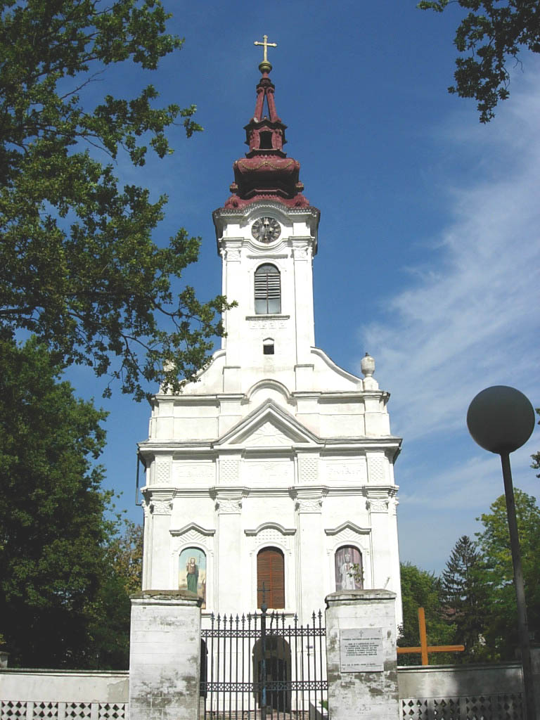
Алибунар— Municipality and Town — Serbian Orthodox church in Alibunar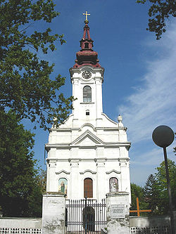

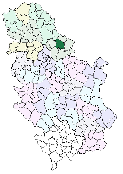
Coat of armsLocation of the municipality of Alibunar within Serbia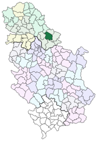
Coordinates: 45°05′N 20°58′E / 45.083°N 20.967°E Country Serbia District South Banat Settlements 10 Government – Mayor Danijel Kišmarton Area[1] – Municipality 602 km2 (232.4 sq mi) Population (2011 census)[2] – Town 3,431 – Municipality 22,954 Time zone CET (UTC+1) – Summer (DST) CEST (UTC+2) Postal code 26310 Area code +381 13 Car plates PA Website www.alibunar.org.rs 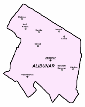 Map of Alibunar municipality
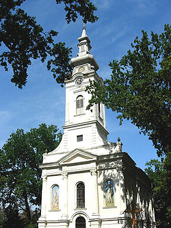 The Romanian Orthodox church
Alibunar (Алибунар) is a town and municipality in South Banat District of Vojvodina, Serbia. Alibunar town has a population of 3,402, and Alibunar municipality 22,856.
Contents
Name
In Serbian, the town is known as Alibunar or Алибунар, in Romanian as Alibunar, in German as Alisbrunn, in Hungarian as Alibunár, and in Turkish as Alipınar.
The name of the town derived from the Serbian word "bunar" ("well" in English) and Muslim/Turkish personal name "Ali". According to the local legend, Alibunar was named after Ali-paša (Ali-pasha), who had a cattle and a well at this place. Even today, there is a well in the town which is known as "Ali-pašin bunar" ("well of Ali-paša"). Before the Ottoman rule, Alibunar was known as "Krsturnica".
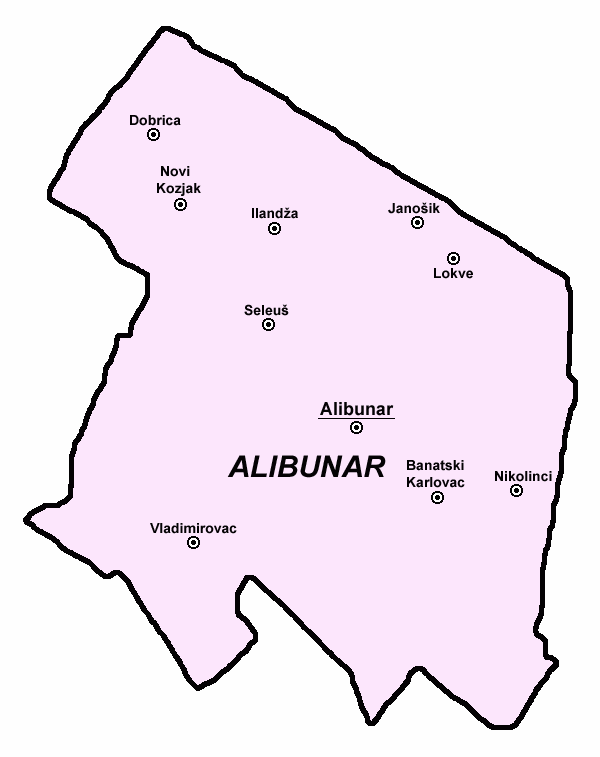
Inhabited places
Alibunar municipality encompasses of town of Alibunar, town of Banatski Karlovac, and following villages:
- Dobrica
- Novi Kozjak
- Ilandža
- Seleuš (Romanian: Seleuș)
- Vladimirovac (Romanian: Petrovasila)
- Janošik (Slovak: Janošík)
- Lokve (Romanian: Sânmihai)
- Nikolinci (Romanian: Nicolinț)
History
In this area, settlements existed in Neolith, Bronze Age and Roman times. However, settlement appeared in historical sources in the 16th century. First recorded name of the settlement was Alijina Voda ("the water of Alija"), presumably named after its Muslim citizen Alija or Ali-paša, who had a house with stone well ("bunar" in Serbian) in the center of the settlement (hence the current name Alibunar or "the well of Ali"). After Ottomans were expelled from this region (in 1717), the settlement had 32 houses. In 1764, settlement was included into Illyrian (Serbian) regiment of Banatian Military Frontier, but in the next year, it was transferred to German regiment of this frontier. Before the inclusion into military frontier, Alibunar had ethnic Serb population, but after it became part of the frontier, 130 mostly Romanian and some 20-30 German families settled in this place. Serbs remained to live in older part of the settlement, Germans settled in its central parts and Romanians in northern parts. Serbian Orthodox church in the settlement was built in 1796.
Source: Stevan Kovačević, Gradovi Srbije u slici i reči, Beograd, 2010.
Historical population
Population of the town in different censuses:
- 1948: 3,616
- 1953: 3,811
- 1961: 3,705
- 1971: 3,951
- 1981: 3,803
- 1991: 3,738
- 2002: 3,431
Ethnic groups (2002 census)
The population of the Alibunar municipality:
- Serbs = 13,680 (59.59%)
- Romanians = 6,076 (26.47%)
- Slovaks = 1,195 (5.2%)
- Roma = 657 (2.86%)
- Hungarians = 309 (1.34%)
Settlements with a Serb ethnic majority are: Alibunar, Banatski Karlovac, Vladimirovac, Dobrica, Ilandža, and Novi Kozjak. The settlement with a Slovak ethnic majority is Janošik. The settlements with Romanian ethnic majority are: Lokve and Nikolinci. The ethnically mixed settlement with a relative Romanian majority is Seleuš.
The municipality of Alibunar contains the biggest ethnic Romanian community in Vojvodina.
The population of the Alibunar town:
- Serbs = 2,052 (59.81%)
- Romanians = 960 (27.98%)
- Roma = 87 (2.54%)
- Hungarians = 61 (1.78%)
- Slovaks = 46 (1.34%)
- Macedonians = 43 (1.25%)
- Yugoslavs = 42 (1.22%)
See also
- List of places in Serbia
- List of cities, towns and villages in Vojvodina
References
- Jovan Erdeljanović, Srbi u Banatu, Novi Sad, 1992.
- Slobodan Ćurčić, Broj stanovnika Vojvodine, Novi Sad, 1996.
Notes
- ^ "Municipalities of Serbia, 2006". Statistical Office of Serbia. http://webrzs.stat.gov.rs/axd/en/Zip/OG2006webE.zip. Retrieved 2010-11-28.
- ^ "2011 Census of Population, Households and Dwellings in the Republic of Serbia – FIRST RESULTS". Bulletin (Statistical Office of the Republic of Serbia) 540. 2011. ISSN 0354-3641. http://media.popis2011.stat.rs/2011/prvi_rezultati.pdf. Retrieved 2011-11-21.
External links
- Official site
- JP Turist Alibunar - official site
- Alibunar Coat of Arms
- (Romanian)Monografia Alibunarului
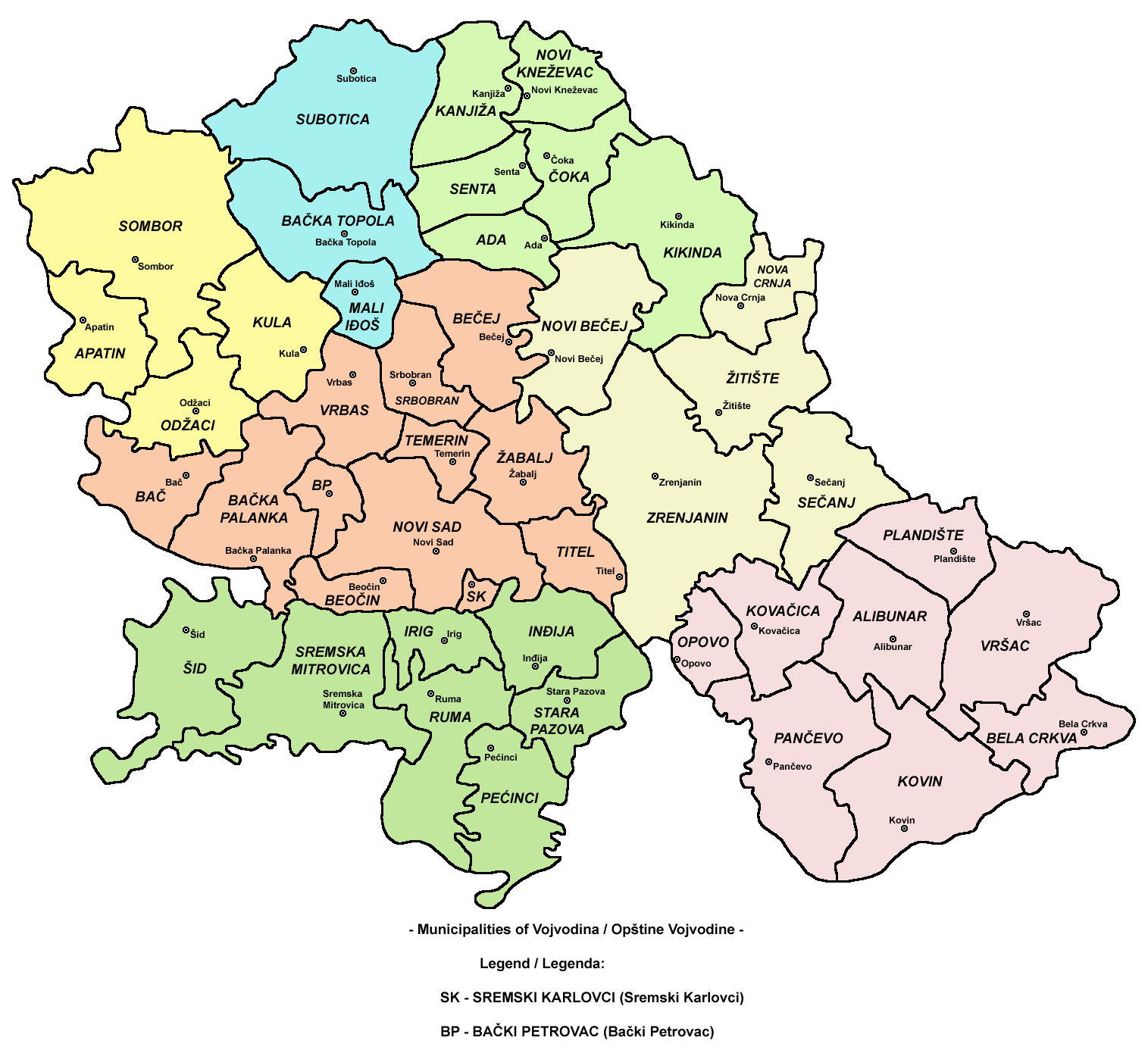
Municipalities and cities of Serbia Central Serbia Belgrade (Barajevo • Čukarica • Grocka • Lazarevac • Mladenovac • Novi Beograd • Obrenovac • Palilula • Rakovica • Savski Venac • Sopot • Stari Grad • Surčin • Voždovac • Vračar • Zemun • Zvezdara) • Čačak • Jagodina • Kragujevac (Aerodrom • Pivara • Stanovo • Stari Grad • Stragari) • Kraljevo • Kruševac • Leskovac • Loznica • Niš (Crveni Krst • Medijana • Niška Banja • Palilula • Pantelej) • Novi Pazar • Požarevac • Smederevo • Šabac • Užice • Valjevo • Vranje • Zaječar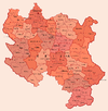 Aleksandrovac • Aleksinac • Aranđelovac • Arilje • Babušnica • Bajina Bašta • Batočina • Bela Palanka • Blace • Bogatić • Bojnik • Boljevac • Bor • Bosilegrad • Brus • Bujanovac • Crna Trava • Čajetina • Ćićevac • Ćuprija • Despotovac • Dimitrovgrad • Doljevac • Gadžin Han • Golubac • Gornji Milanovac • Ivanjica • Kladovo • Knić • Knjaževac • Koceljeva • Kosjerić • Krupanj • Kučevo • Kuršumlija • Lajkovac • Lapovo • Lebane • Lučani • Ljig • Ljubovija • Majdanpek • Mali Zvornik • Malo Crniće • Medveđa • Merošina • Mionica • Negotin • Nova Varoš • Osečina • Paraćin • Petrovac • Pirot • Požega • Preševo • Priboj • Prijepolje • Prokuplje • Rača • Raška • Ražanj • Rekovac • Sjenica • Smederevska Palanka • Sokobanja • Surdulica • Svilajnac • Svrljig • Topola • Trgovište • Trstenik • Tutin • Ub • Varvarin • Velika Plana • Veliko Gradište • Vladičin Han • Vladimirci • Vlasotince • Vrnjačka Banja • Žabari • Žagubica • Žitorađa
Vojvodina 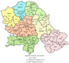 Ada • Alibunar • Apatin • Bač • Bačka Palanka • Bačka Topola • Bački Petrovac • Bečej • Bela Crkva • Beočin • Čoka • Inđija • Irig • Kanjiža • Kikinda • Kovačica • Kovin • Kula • Mali Iđoš • Nova Crnja • Novi Bečej • Novi Kneževac • Odžaci • Opovo • Pećinci • Plandište • Ruma • Sečanj • Senta • Šid • Srbobran • Sremski Karlovci • Stara Pazova • Temerin • Titel • Vrbas • Vršac • Žabalj • Žitište
Kosovo Dečani • Đakovica • Dragaš • Glogovac • Gnjilane • Istok • Kačanik • Klina • Kosovo Polje • Kosovska Kamenica • Kosovska Mitrovica • Leposavić • Lipljan • Mališevo • Novo Brdo • Obilić • Orahovac • Peć • Podujevo • Priština • Prizren • Štimlje • Srbica • Štrpce • Suva Reka • Uroševac • Vitina • Vučitrn • Zubin Potok • Zvečan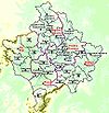 New Municipalities: Đeneral Janković • Gračanica • Junik • Klokot-Vrbovac • Mamuša • Parteš • RanilugPlanned Municipality: North Kosovska MitrovicaCategories:
- Vojvodina geography stubs
- Places in Serbian Banat
- Populated places in Vojvodina
- Municipalities of Vojvodina


Wikimedia Foundation. 2010.