- Auburn, Massachusetts
Infobox Settlement
official_name = Auburn, Massachusetts
nickname =
motto =
imagesize =
image_caption =
image_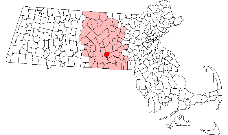
mapsize = 250px
map_caption = Location in Worcester County in Massachusetts
mapsize1 =
map_caption1 =
subdivision_type = Country
subdivision_name =United States
subdivision_type1 = State
subdivision_name1 =Massachusetts
subdivision_type2 = County
subdivision_name2 = Worcester
established_title = Settled
established_date = 1714
established_title2 = Incorporated
established_date2 = 1778
established_title3 =
established_date3 =
government_type =Representative town meeting
leader_title = Town Administrator
leader_name = Charles T. O'Connor
leader_title1 = Board of
Selectmen
leader_name1 = William Gribbons
Robert Grossman
Elizabeth Prouty
Robert Valentine
Carl Westerman
area_magnitude =
area_total_km2 = 42.5
area_total_sq_mi = 16.4
area_land_km2 = 39.8
area_land_sq_mi = 15.4
area_water_km2 = 2.7
area_water_sq_mi = 1.0
population_as_of = 2000
settlement_type = Town
population_total = 15901
population_density_km2 = 399.7
population_density_sq_mi = 1035.3
elevation_m = 184
elevation_ft = 603
timezone = Eastern
utc_offset = -5
timezone_DST = Eastern
utc_offset_DST = -4
latd = 42 |latm = 11 |lats = 40 |latNS = N
longd = 71 |longm = 50 |longs = 10 |longEW = W
website = [http://www.town.auburn.ma.us/ www.town.auburn.ma.us]
postal_code_type = ZIP code
postal_code = 01501
area_code = 508 / 774
blank_name = FIPS code
blank_info = 25-02760
blank1_name = GNIS feature ID
blank1_info = 0619474
footnotes =Auburn is a town in Worcester County,
Massachusetts ,United States . The population was 15,901 at the 2000 census.History
Auburn was first settled in 1714 and was officially incorporated in 1778 as the town of Ward, in honor of
American Revolution GeneralArtemas Ward . The town changed its name to Auburn in 1837, after the Post Office complained that the name was too similar to the nearby town of Ware.Before incorporation, most of Auburn was known as the South Parish of Worcester; other portions fell within the town limits of Leicester and Millbury.
Robert H. Goddard launched the first liquid-fueled rocket from his Aunt Eiffie's farm in Auburn onMarch 16 ,1926 . Goddard is commemorated in Goddard Memorial Park located downtown next to the Auburn Fire Department Headquarters.In this park there is a model of Dr. Goddard's prototype liquid fueled rocket and a Polaris Ballistic Missile (Type A-1). Across the street at the Auburn High School stands a mini version of the prototype.
In addition, there is a small memorial commemorating the feat on the actual site where Goddard launched his rocket. [ [http://www.nps.gov/nhl/designations/Lists/MA01.pdf National Historic Landmarks Survey, by State - Massachusetts] see page 8, accessed Oct. 19, 2007] (The memorial is located between the 1st and 9th holes on Pakachoag Golf Course.)
Geography
Demographics
As of the
census GR|2 of 2000, there were 15,901 people, 6,346 households, and 4,404 families residing in the town. Thepopulation density was 1,035.3 people per square mile (399.7/km²). There were 6,579 housing units at an average density of 428.4/sq mi (165.4/km²). The racial makeup of the town was 97.54% White, 0.58% African American, 0.11% Native American, 0.89% Asian, 0.03% Pacific Islander, 0.23% from other races, and 0.62% from two or more races. Hispanic or Latino of any race were 1.04% of the population.There were 6,346 households out of which 28.1% had children under the age of 18 living with them, 57.6% were married couples living together, 8.7% had a female householder with no husband present, and 30.6% were non-families. 25.7% of all households were made up of individuals and 13.5% had someone living alone who was 65 years of age or older. The average household size was 2.48 and the average family size was 3.01.
In the town the population was spread out with 22.7% under the age of 18, 5.4% from 18 to 24, 28.6% from 25 to 44, 25.2% from 45 to 64, and 18.1% who were 65 years of age or older. The median age was 41 years. For every 100 females there were 90.9 males. For every 100 females age 18 and over, there were 87.4 males.
The median income for a household in the town was $51,753, and the median income for a family was $60,805. Males had a median income of $42,893 versus $31,121 for females. The
per capita income for the town was $23,802. About 2.7% of families and 3.3% of the population were below thepoverty line , including 3.5% of those under age 18 and 4.1% of those age 65 or over.Government
Infobox Mass Town Govt
county= Worcester
clerk_courts = Dennis P. McManus (D)
cty_treasurer = Position Eliminated
da = Joseph D. Early, Jr. (D)
deeds = Anthony J. Vigliotti (D)
probate = Stephen Abraham (D)
sheriff = Guy W. Glodis (D)
state_rep = Paul K. Frost (R)
state_sen = Edward Augustus, Jr. (D)
gov_councilors = Thomas J. Foley (D)
fed_rep = James P. McGovern (D-3rd District),
fed_sen =Edward Kennedy (D)John Kerry (D)Education
Auburn has two elementary school "districts." Homes north and west of Route 12 (Southbridge Street) feed into Bryn Mawr School (grades K-2) and Julia Bancroft School (grades 3-5). The other half of town feeds into Mary D. Stone School (grades K-2) and Pakachoag School (grades 3-5). All Auburn public school students attend Auburn Middle School (grades 6-8). Some students attend Auburn High School (grades 9-12), while others are given the option to attend
Bay Path Regional Vocational Technical High School instead. A new high school opened on Drury Square in the center of town directly next to the old high school, equipped with a new turf football field, all-purpose field, baseball field, and a grass softball field, as well as new tennis courts, in 2006; a group called "Save the '35" protested demolition of the oldest (1935) wing of the former high school. The old high school has now been completely demolished, except the dome on top of the high school. Few of the bricks of the old building were sold within the town, and there are some located at the Auburn Historical Museum.The town voted in 2008 not to build a new library
Points of interest
*
Goddard Rocket Launching Site
* Auburn High School
*Auburn Mall
*Auburn Middle School
*Rocketland Park
*Pakachoag Golf Course
*Crystal Caves Mini-Golf and Ice Cream
*Park N' Shop
*Auburn Historical Society
*Hampton Place
*Ronnies Seafood and Ice Cream
*AMF Bowling
*Horgan Skating Rink
*Auburn Public LibraryNotable residents
*
Jacob Whitman Bailey , biologist, educatorcite book | title = Who Was Who in America, Historical Volume, 1607-1896 | publisher = Marquis Who's Who | location = Chicago | date = 1967]References
External links
* [http://www.auburnguide.com Town of Auburn]
* [http://www.auburnmassfire.org Auburn Fire/Rescue]
Wikimedia Foundation. 2010.