- Clayton, Greater Manchester
-
Coordinates: 53°29′07″N 2°10′42″W / 53.485278°N 2.178333°W
Clayton 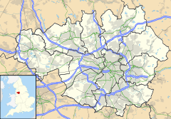
 Clayton
Clayton shown within Greater ManchesterMetropolitan borough Manchester Metropolitan county Greater Manchester Region North West Country England Sovereign state United Kingdom Post town MANCHESTER Postcode district M11 Dialling code 0161 Police Greater Manchester Fire Greater Manchester Ambulance North West EU Parliament North West England List of places: UK • England • Greater Manchester Clayton is a suburb of the city of Manchester, in North West England. It is situated about 3 miles east of the city centre, on Ashton New Road. Clayton takes its name from the Clayton family[citation needed] who owned large parts of land around the area, including Clayton Vale, through which the River Medlock flows (separating Clayton from neighbouring Newton Heath). Clayton was once under the township of Droylsden up until around 1890 when alterations to the Manchester boundary took place. Other towns added to Manchester around this time were Blackley, Crumpsall, Moston, Openshaw and Gorton.[1]
Contents
Football connection
Main article: Bank Street (football ground)Clayton was home to Manchester United F.C. for 17 years from 1893 to 1910. As Newton Heath L&YR F.C., they played at North Road in Newton Heath from their formation in 1878 until 1893 when they moved to a ground on Bank Street, before moving to Old Trafford in 1910. Just after United vacated the Bank Street stadium, it was severely damaged in a storm and the remains were demolished soon after.[2]
The club was renamed Manchester United in 1902 and they moved to their present ground in Old Trafford, just outside Manchester, in 1910.[3]
Manchester Velodrome opened at Clayton in September 1994 and a car park serving it was constructed on the site of Manchester United's old stadium.
Less than 700 yards away from the original home of Manchester United in Clayton, Manchester City F.C. moved into their new 48,000-seat stadium in 2003, which is situated approximately one mile away from the area where Manchester City first formed as St. Mark's, in west Gorton.
Clayton Hall
Main article: Clayton Hall Clayton Hall today
Clayton Hall is a 15th century hall on Ashton New Road, in Manchester, hidden behind trees in a small park.[4] The Hall is a Grade II* listed building,[5] a scheduled ancient monument, and is rare example of a medieval moated site (grid reference SJ88099857).[6] It was originally built for the Clayton Family, it passed on into the hands of the Byron family (of which the poet Lord Byron was a member) in 1194. They lived there until they sold it to two London merchants, George and Humphrey Chetham, in 1620.[citation needed] Humphrey Chetham is famous for founding Chetham's School and Library in the centre of Manchester.
During the Civil War, Royalist cavalry were stationed here, before the attack on Manchester. Afterwards, according to legend, Oliver Cromwell was said to have spent three nights at the Hall.[citation needed] In 1897 the building was acquired by Manchester City Corporation, ensuring its survival.
Clayton today
Philips Park is on the south side of the River Medlock and Philips Park Cemetery is on the north side. The park has the distinction of being Manchester's first public park and Mark Philips, who was the Member of Parliament for Manchester, opened it in 1846. It was the first of its kind in the whole of the then Great Britain and Ireland and it set the standard for many others that soon followed in towns and cities throughout Britain. It was designed to have walks, expansive lakes and glasshouses for exotic plants. It is also famous for its annual Tulip Festival, which is still held every year. Philips Park Cemetery was opened in 1863.
The majority of houses in Clayton are council homes. The first council (or then known as corporation) homes to built took place around the late 1920s, building near the border of Droylsden (Bristowe Street and South Crescent, followed by North Crescent). Many more homes were to be built afterwards, building on a brick works surrounding Clayton Street, a golf course off what is now Folkstone Road West and East and cricket & football grounds off North Road and Vale Street, now known as Lingfield Road. The building associated with the cricket and football grounds still stands today, now used as a boxing club.
Frank Pritchard, on recalling his memories of living in Clayton as young child during the 1920s in his book East Manchester Remembered, says "... Clayton was rather a posh area. Beyond Bank Street one rarely saw children bare-footed, or with their breeches' behind torn and tattered which were common sights in the streets round where I lived."[7]
After a period of general decline from around the mid to late 1980s to around 2004, Clayton residents have since seen some improvements along its main routes, both in terms of housing repairs/modernisation and road reconstructions. In 2009-10 these improvements have been extended to some of Clayton's back streets; more notably in the Stanton Street and surrounding area.
Church and community
Father Ansbro is the priest at St. Willibrord's Church. The church had some alterations to its interior in 2006-07 making the back of the church a focal point for various local community assemblies, where various charity fund-raising events are organised.
The Church of St Cross was built in the 19th century and designed by William Butterfield. Butterfield was known for his budget conscious churches.[citation needed] The building is unique for its patterned brickwork and the richly furnished interior.[citation needed]
See also
- Bank Street (football ground)
- Manchester Clayton (UK Parliament constituency)
- John Edward Sutton
- Edward Hopkinson
- Shane Ward
References
- ^ "Greater Manchester Gazetteer". Greater Manchester County Record Office. http://www.gmcro.co.uk/Guides/Gazeteer/gazintro.htm.
- ^ Murphy, Alex (2006). "1878–1915: From Newton Heath to Old Trafford". The Official Illustrated History of Manchester United. London: Orion Books. p. 14. ISBN 0-7528-7603-1.
- ^ "History of Manchester United". Manchester United Official Website. 2008-03-30. http://www.manutd.com/default.sps?pagegid={E0DB31FD-0C0E-49D7-98B7-AA7B75FF0E21}§ion=decadeDetails§ionid=942&customPageID=942.. Retrieved 2008-03-30.
- ^ Manchester City Council. "Ancient monuments in Manchester". Manchester.gov.uk. http://www.manchester.gov.uk/site/scripts/documents_info.php?documentID=1430. Retrieved 2007-12-29.
- ^ "Clayton Hall". Images of England. http://www.imagesofengland.org.uk/Details/Default.aspx?id=387908. Retrieved 2007-12-29.
- ^ "Clayton Hall". Pastscape.org.uk. http://www.pastscape.org.uk/hob.aspx?hob_id=76619&search=all&criteria=clayton%20hall&p=1. Retrieved 2007-12-29.
- ^ Pritchard, Frank (1989). East Manchester Remembered. Neil Richardson. ISBN 978-1-85216-039-5.
- 1923 Ordnance Survey Map
The City of Manchester About Manchester Districts Ancoats · Ardwick · Ardwick Green · Baguley · Belle Vue · Benchill · Beswick · Blackley · Bradford · Burnage · Castlefield · Cheetham Hill · Chinatown · Chorlton-cum-Hardy · Chorlton-on-Medlock · Chorltonville · City Centre · Clayton · Collyhurst · Crumpsall · Didsbury · Fallowfield · Gay Village · Gorton · Harpurhey · Hulme · Levenshulme · Longsight · Lower Crumpsall · Miles Platting · Moss Side · Moston · Newall Green · New Islington · New Moston · Newton Heath · Northenden · Northern Moor · Northern Quarter · Openshaw · Peel Hall · Piccadilly Village · Ringway · Rusholme · Sharston · Spinningfields · Whalley Range · Withington · Woodhouse Park · WythenshaweCategories:- Greater Manchester articles needing cleanup
- Districts of Manchester


Wikimedia Foundation. 2010.