- Chimborazo (volcano)
-
This article is about the volcano. For the Ecuadorian province, see Chimborazo Province.
Chimborazo 
Chimborazo, The closest point to space and to the sun[1]Elevation 6,268.2 m (20,565 ft) [note 1] Prominence 4,123 m (13,527 ft) Ranked 17th Listing Country high point
UltraLocation 
 Chimborazo
 Ecuador
Range Andes, Cordillera Occidental Coordinates 01°28′09″S 78°49′03″W / 1.46917°S 78.8175°WCoordinates: 01°28′09″S 78°49′03″W / 1.46917°S 78.8175°W Topo map IGM, CT-ÑIV-C1 [3] Geology Type Stratovolcano Age of rock Paleogene[4] Last eruption 550 AD ± 150 years [5] Climbing Easiest route Glacier/snow climb PD Chimborazo (Spanish pronunciation: [tʃimboˈɾaso]) is a currently inactive stratovolcano located in the Cordillera Occidental range of the Andes. Its last known eruption is believed to have occurred around 550 AD[6].
With a peak elevation of 6,268.2 metres (20,565.0 ft), Chimborazo is the tallest mountain in Ecuador. It is the tallest peak of note in close proximity to the equator. While Chimborazo is not the tallest mountain by height above sea level, its location along the equatorial bulge makes its summit the farthest point on the Earth's surface from its center.
Contents
Geography
Location
Chimborazo is located in the Cordillera Occidental of the Andes of central Ecuador, 150 km (93 mi) south-southwest of the capital Quito. It is a neighbour to 5,018 m high Carihuairazo. Chimborazo's summit rises 2,500 m above the surrounding highlands (~3,500 to 4,000 m) with a ~20 km wide base.
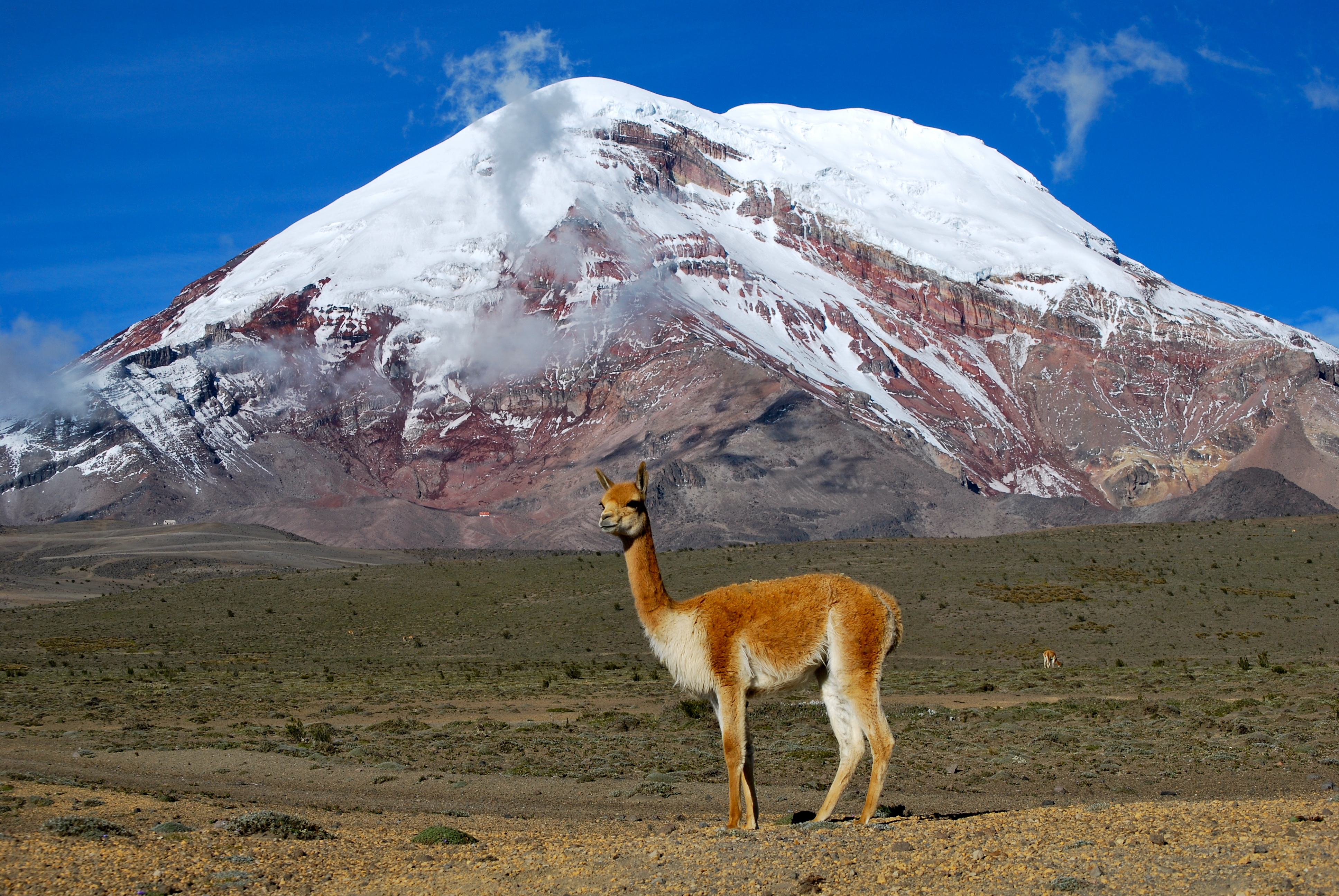
Under clear conditions the summit of Chimborazo can be seen from the coastal city Guayaquil, nearly 140 km away. The nearest cities are Riobamba (~30 km to the southeast), Ambato (~30 km to the northeast) and Guaranda (~25 km to the southwest). Chimborazo is surrounded by the Reserva de Produccion Faunistica Chimborazo which forms a protected ecosystem to preserve the habitat for the Andes native camelids of vicuña, llama and alpaca.
Glacier
The top of Chimborazo is completely covered by glaciers, with some north-eastern glacier arms flowing down to 4,600 m. Its glacier is the source of water for the population of the Bolivar and Chimborazo provinces of Ecuador. Chimborazo glacier's ice mass has decreased over the past decades, which is thought by some to be due to the combined influences of global warming, ash covers from recent volcanic activity[note 2] of Tungurahua, and the El Niño phenomenon.[8][9]
As on other glaciated Ecuadorian mountains, Chimborazo's glacial ice is mined by locals (the so called Hieleros from Spanish Hielo for Ice) to be sold in the markets of Guaranda and Riobamba. In earlier days, the people transported ice for cooling uses down to coastal towns such as Babahoyo or Vinces.[10]
Volcanism
Chimborazo is a dominantly andesitic-dacitic stratovolcano. About 35,000 years ago a collapse of Chimborazo produced a debris avalanche, the deposits of which underlie Riobamba. Chimborazo then erupted several times during the Holocene, the last time around 550 AD ± 150 years.[5] Today Chimborazo is considered inactive.
Elevation
With an elevation of 6,268 m,[note 1] Chimborazo is the highest mountain in Ecuador and the Andes north of Peru; it is higher than any more northerly summit in the Americas.
Farthest point from Earth's center
The summit of Mount Everest reaches a higher elevation above sea level, but the summit of Chimborazo is widely reported to be the farthest point on the surface from Earth's center,[11][12] with Huascarán a very close second. The summit of the Chimborazo is the fixed point on Earth which has the utmost distance from the center – because of the modified ball shape of the planet Earth which is "thicker" around the Equator than measured around the poles.[note 3] Chimborazo is one degree south of the Equator and the Earth's diameter at the Equator is greater than at the latitude of Everest (8,848 m (29,029 ft) above sea level), nearly 28° north, with sea level also elevated. Despite being 2,580 m (8,465 ft) lower in elevation above sea level, it is 6,384.4 km (3,967.1 mi) from the Earth's centre, 2,168 m (7,113 ft) or 2.168 km (1.347 mi) farther than the summit of Everest (6,382.3 km (3,965.8 mi) from the Earth's center).[note 4] However, by the criterion of elevation above sea level, Chimborazo is not even the highest peak of the Andes.
-

Vicuña, one of two wild South American camelids
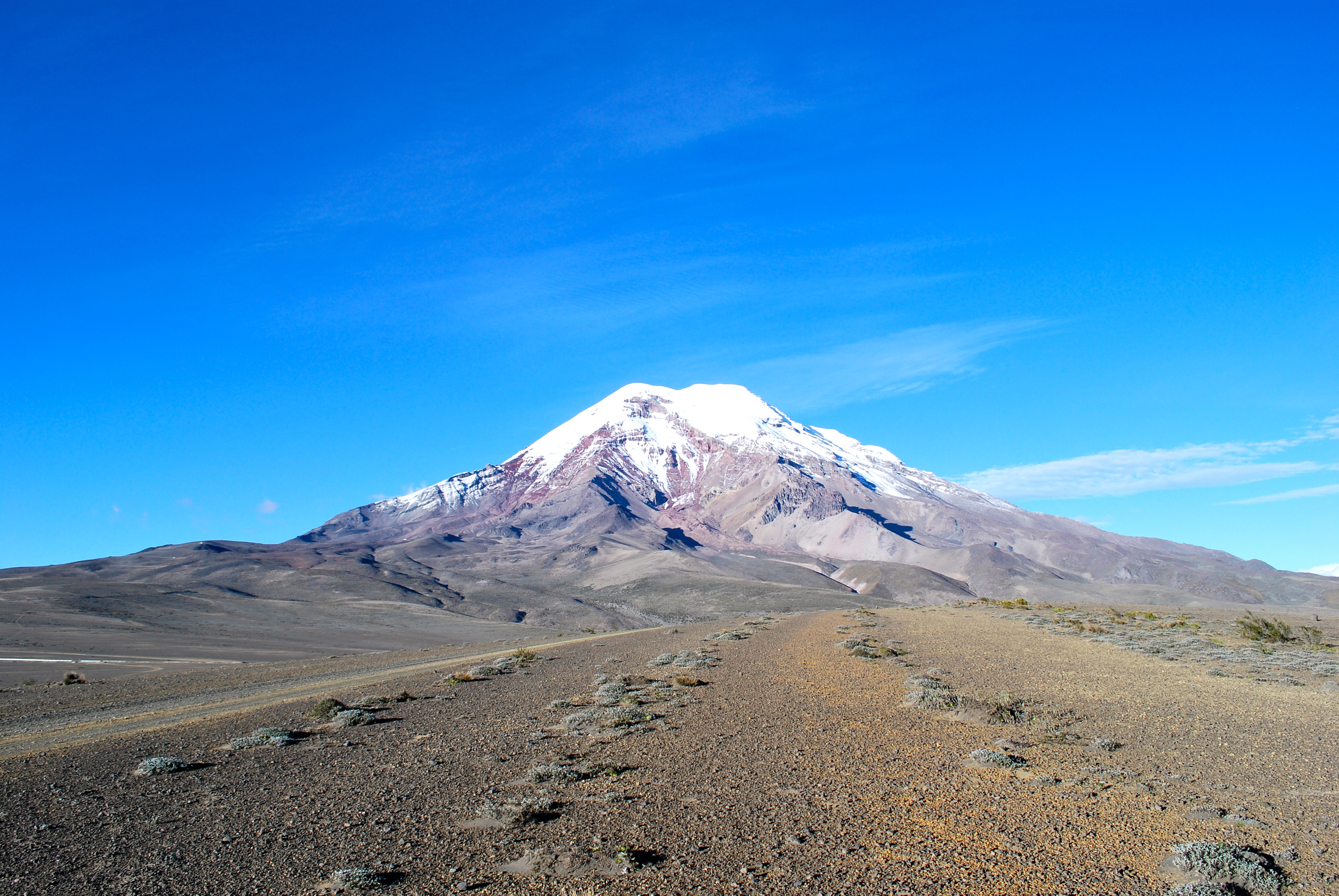
-
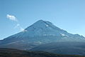
Chimborazo from the west
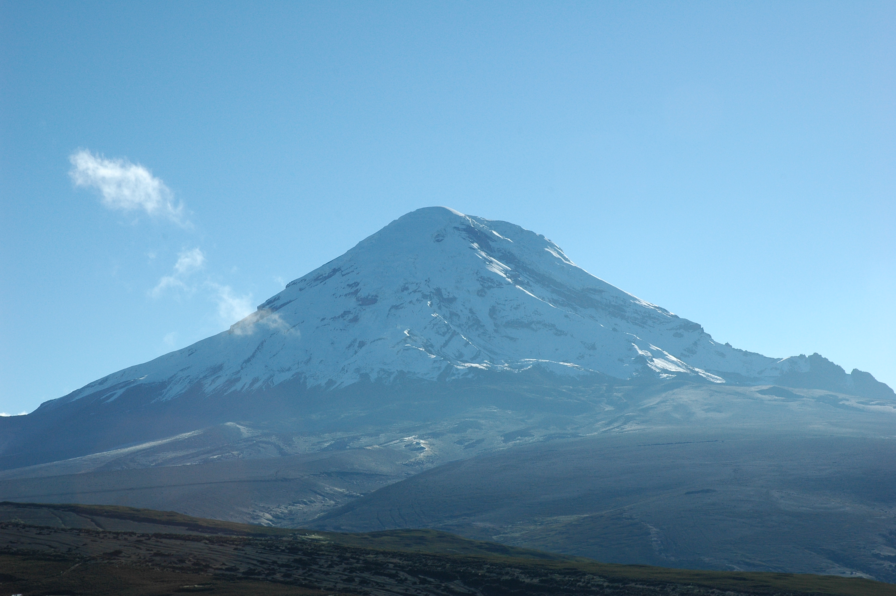
-
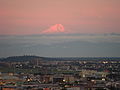
Chimborazo as seen from Guayaquil
-
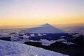
The shadow of Chimborazo as seen from the summit at sunrise
-

False-colour satellite image of Chimborazo (bright blue mass in the center left) and its neighbour Tungurahua (center right, with plume of ash).
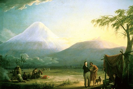
-

Alexander von Humboldt and Aimé Bonpland at the Chimborazo base
History
Etymology
Several theories regarding the origin of the name Chimborazo exist. In many dialects of Quichua or Quechua, "chimba" means "on the other side" as in "on the other side of the river" or "on the opposite bank." Other dialects pronounce this word "chimpa." Also, "razu" means "ice" or "snow." Local Quichua speakers will say that Chimborazo is a hispanicized pronunciation of "chimbarazu," meaning "the snow on the other side." [13] Another theory suggests it is a combination of the Cayapa Schingbu for Women and the Colorado/Quichua Razo for Ice/Snow resulting in Women of Ice. According to another, Chimbo is Jivaro for Throne of Master/God resulting in Icethrone of God. The locals also used to call the mountain Urcurazu, with the Quichua Urcu for Mountain resulting in Mountain of Ice.[14] In local indigenous mysticism, Chimborazo represents Taita (Father) whereas neighbouring Tungurahua is seen as Mama, hence Taita Chimborazo and Mama Tungurahua.
First ascent
Until the beginning of the nineteenth century it was thought that Chimborazo was the highest mountain on Earth (measured from sea level), and such reputation led to many attempts on its summit during the seventeenth and eighteenth centuries. In 1802 during his expedition to South America, Baron Alexander von Humboldt, accompanied by Aimé Bonpland and the Ecuadorian Carlos Montúfar attempted to reach the summit. From his description of the mountain it seems that before he and his companions had to return suffering from altitude sickness they reached a point at 5,875 m, higher than previously attained by any European in recorded history.[note 5] In 1831 Jean Baptiste Boussingault and Colonel Hall reached a new "highest point", computed to be 6,006 m.[15][16] In 1880 Chimborazo's summit was first climbed by Edward Whymper and the brothers Louis and Jean-Antoine Carrel. As there were many critics who doubted that Whymper had reached the summit, later in the same year he climbed to the summit again choosing a different route (Pogyos) with the Ecuadorians David Beltrán and Francisco Campaña.[17]
SAETA Flight 232
In August 1976 SAETA Flight 232 carrying 55 passengers and four crew members aboard a Vickers Viscount from Quito to Cuenca disappeared en route. In October 2002, after 26 years, the aircraft was found with the bodies of its 59 occupants at 5,400 metres (17,700 ft) elevation on Chimborazo by Ecuadorian climbers on the rarely used eastern route Integral.[18]
Other
- Chimborazo is featured on the Ecuadorian coat of arms, to represent the beauty and richness of the Ecuadorian Sierra (Highlands).
- Simón Bolívar's poem, "Mi delirio sobre el Chimborazo", was inspired by the mountain.
- Walter J. Turner's poem, "Romance" contains the couplet "Chimborazo, Cotopaxi/They had stolen my soul away!"[19]
- Luis Alberto Costales's poem, "Canto al Chimborazo" (Sing of Chimborazo).[20]
Mountaineering
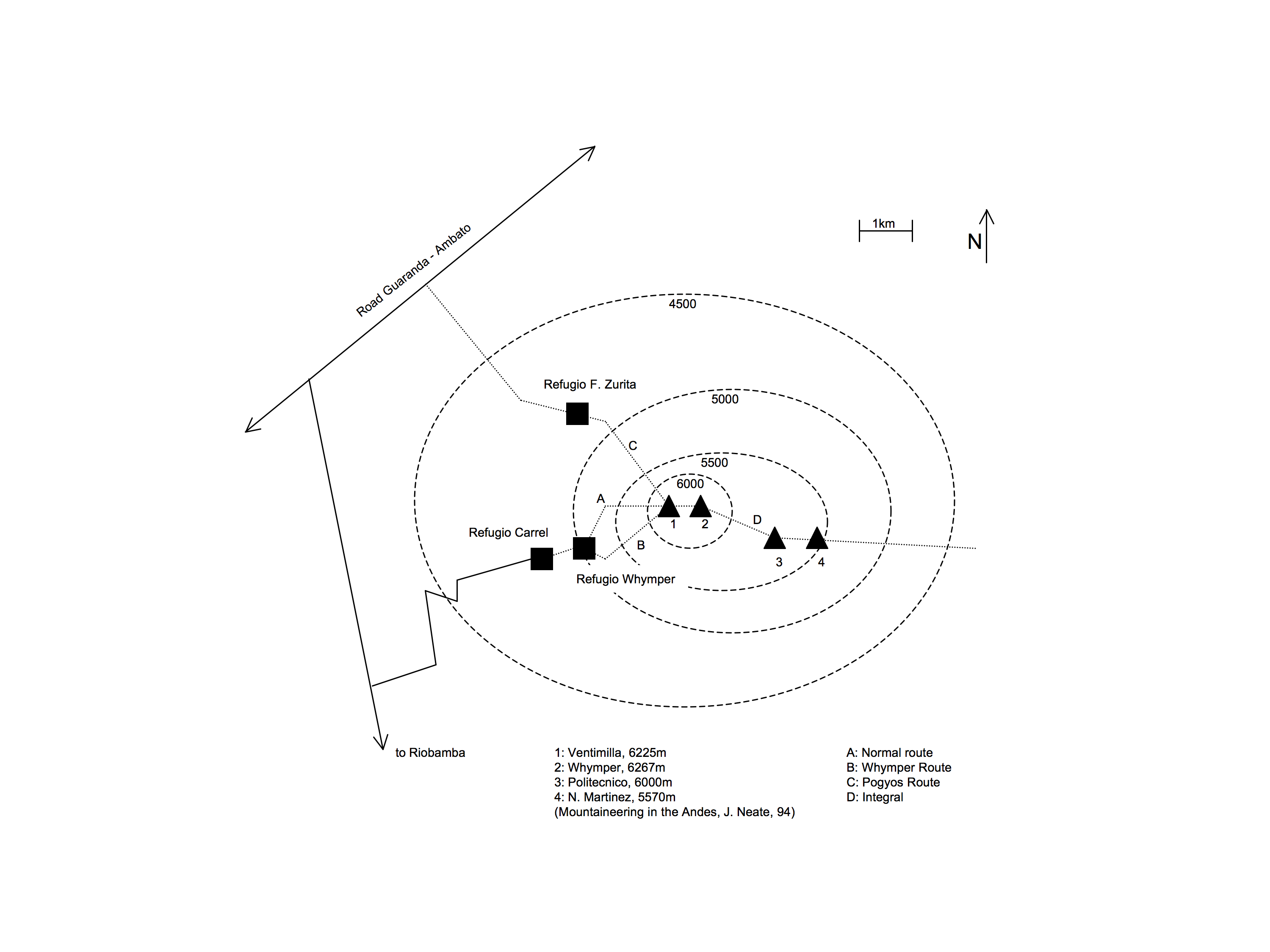
 Sketch of Chimborazo huts, main summits, and routes
As Ecuador's highest mountain, Chimborazo is a very popular climb and can be climbed year round with the best seasons being December–January and July–August.
Routes
The easiest (Grade: PD) and most climbed routes are the Normal and the Whymper route. Both are western ridge routes starting at the Whymper hut and leading via the Ventemilla summit to the main (Whymper) summit. There are several other less used and more challenging routes on the other mountains faces and ridges leading to one of Chimborazo's summits: Main (Whymper, Ecuador), Politecnico (Central), N. Martinez (Eastern). The mountain is contained on the IGM (Instituto Geografico Militar) 1:50000 Map Chimborazo (CT-ÑIV-C1).[3]
Refugios
There are two functioning Huts, the Carrel Hut (4,850 m) and the nearby Whymper Hut (5,000 m). The Carrel Hut can be reached by car from Riobamba, Ambato or Guaranda. On the north-west side there is the now defunct Zurita hut (4,900 m) which served as base for the Pogyos route.[14]
See also
Notes
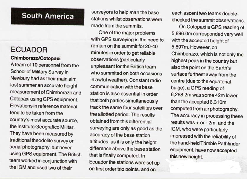
- ^ a b The elevation given here was established by a differential GPS survey in 1993; see World Mountaineering in the references. The survey was carried out by a team of 10 personnel from the School of Military Survey in Newbury, United Kingdom, working in cooperation with the Ecuadorian Instituto Geografico Militar. Accuracy of ±2 m is claimed.[2] This figure is compatible with SRTM data, unlike an older but still frequently given figure of 6,310 metres (20,702 ft).
- ^ Tungurahua's recent activity period started in 1999 with the most significant eruptions between October and December 1999 and May and July 2006.[7]
- ^ It has been difficult to resolve this issue definitively because of error margins in summit elevations and geoid data. Application of the formula at Earth radius#Radius at a given geodetic latitude shows that Earth's radius is 520 metres (1,710 ft) greater at Chimborazo than at Huascaran, which is 20 metres (66 ft) greater than the sea-level elevation difference (no more than 500 m or 1,600 ft), and the most recent data shows that the geoid at Chimborazo is about 5 metres (16 ft) higher than at Huascaran. This suggests that, despite being 42 metres (138 ft) lower than the 6,310 metres (20,700 ft) it was previously thought to be (and is still frequently claimed to be), Chimborazo's summit is about 25 metres (82 ft) further from the Earth's centre than that of Huascaran.
- ^ In this ranking several other Andean peaks as well as Africa's highest mountain, Kilimanjaro, exceed Everest.
- ^ Incans had reached much higher altitudes previously; see Llullaillaco.
References
- ^ Reaching Earth´s Closest Point to the Sun
- ^ "Ecuador, Chimborazo/Cotopaxi (copy)". Mountain INFO (High Magazine) (136). March 1994. http://www.viewfinderpanoramas.org/chimbo-high2.jpg. Retrieved 2008-08-18.
- ^ a b "Chimborazo Ecuador, CT-ÑIV-C1". IGM (Instituto Geografico Militar, Ecuador). 1991. http://www.igm.gob.ec/cms/files/cartabase/enie/imagenes/ENIEIV_C1_ALTA.jpg. Retrieved 2008-01-26.
- ^ Gomez, Nelson (1994). Atlas del Ecuador. Editorial Ediguias. ISBN 9978-89-009-2.
- ^ a b "Chimborazo". Global Volcanism Program, Smithsonian Institution. http://www.volcano.si.edu/world/volcano.cfm?vnum=1502-071. Retrieved 2009-01-01.
- ^ http://www.volcano.si.edu/world/volcano.cfm?vnum=1502-071
- ^ "Actividad Volcan Tungurahua". Instituto Geofísico, EPN Ecuador. http://www.igepn.edu.ec/INFORMES/volcanicos.asp?volcan=55&tipo=Anual. Retrieved 2007-04-28.
- ^ Chaffaut, Isabelle; Marie Guillaume (2004). "El Niño and glacier melt in the tropical Andes". innovations report. http://www.innovations-report.com/html/reports/earth_sciences/report-35174.html. Retrieved 2006-08-08.
- ^ Schoterer, Ulrich, Grosjean M., Stichler W et al. (2003). "Glaciers and Climate in the Andes between the Equator and 30° S: What is Recorded under Extreme Environmental Conditions?". Climatic Change 59: 157. doi:10.1023/A:1024423719288.
- ^ Borja, Carmen (2004). "Hieleros del Chimborazo. Entrevista a Igor Guayasamín". Ecuador Terra Incognita 29.
- ^ Audrey Salkeld, ed., World Mountaineering, Bulfinch Press, 1998, ISBN 0-8212-2502-2, p. 140.
- ^ NPR story
- ^ one online Quechua dictionary which verifies this etymology is as http://www.philip-jacobs.de/runasimi/runasimi.txt
- ^ a b Schmudlach, Günter (2001). Bergführer Ecuador. Panico Alpinverlag. ISBN 3-926807-82-2.
- ^ "Greatest Ascents in the Atmosphere" The Times (London). Wed, September 7, 1836. Issue 16202, col E, p. 2.
- ^ McCosh, Frederick William James (1984). Boussingault: Chemist and Agriculturist. Dordrecht: D. Reidel. ISBN 90-277-1682-X.
- ^ Whymper, Edward (1892). Travels Amongst the Great Andes of the Equator. John Murray. ISBN 1-904466-24-9.
- ^ El Comercio (February to May 2003). "Different Saeta Chimborazo accident articles" (in Spanish). El Comercio, Quito.
- ^ Marsh, Edward Howard, Sir (1917). Georgian Poetry, 1916–1917. The Poetry Bookshop. http://www.gutenberg.org/dirs/etext05/8gp0310.txt. Retrieved 2008-06-23.
- ^ Costales Cazar, Luis Alberto (2005). Sobre el Pomo de la Tierra. Editorial Freire. http://www.worldcat.org/title/sobre-el-pomo-de-la-tierra/oclc/122307496&referer=brief_results. Retrieved 2011-11-09.
External links
- "Climbing information for Chimborazo". Summitpost.org. http://www.summitpost.org/mountain/rock/150349/chimborazo.html. Retrieved 2011-10-25.
- "Chimborazo". Global Volcanism Program, Smithsonian Institution. http://www.volcano.si.edu/world/volcano.cfm?vnum=1502-071. Retrieved 2011-10-25.
- "The last iceman of Chimborazo". http://www.jordibusque.com/index.php?lang=en¤t=stories&subcurrent=ultimo_hielero&subsubcurrent=CF0134-DSC_5492.jpg. Retrieved 2011-10-25.
Categories:- Extreme points of Earth
- Mountains of Ecuador
- Stratovolcanoes
- Volcanoes of Ecuador
- Glaciers of Ecuador
-


Wikimedia Foundation. 2010.